Community Corner
New Photos: Silva’s Crossing Closed as Waters Rise in Uvas Creek
Engineers designed the 'summer crossing' that spans Uvas Creek to be overrun when water levels go up.


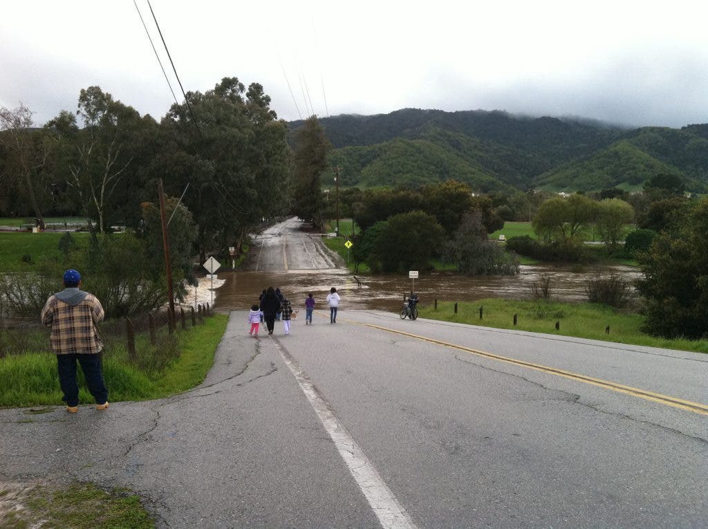

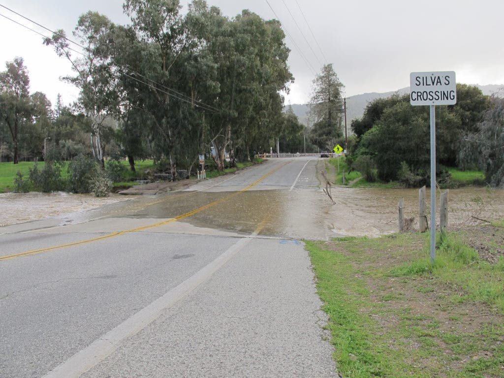
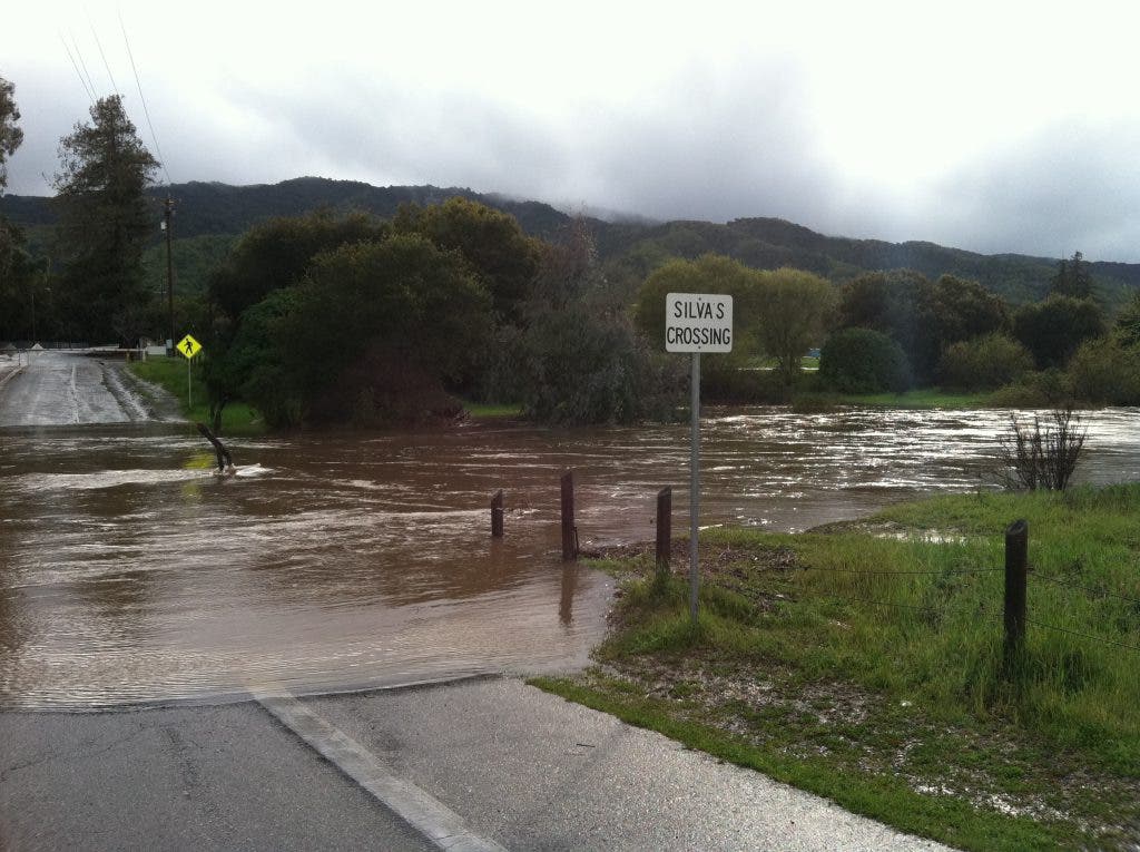

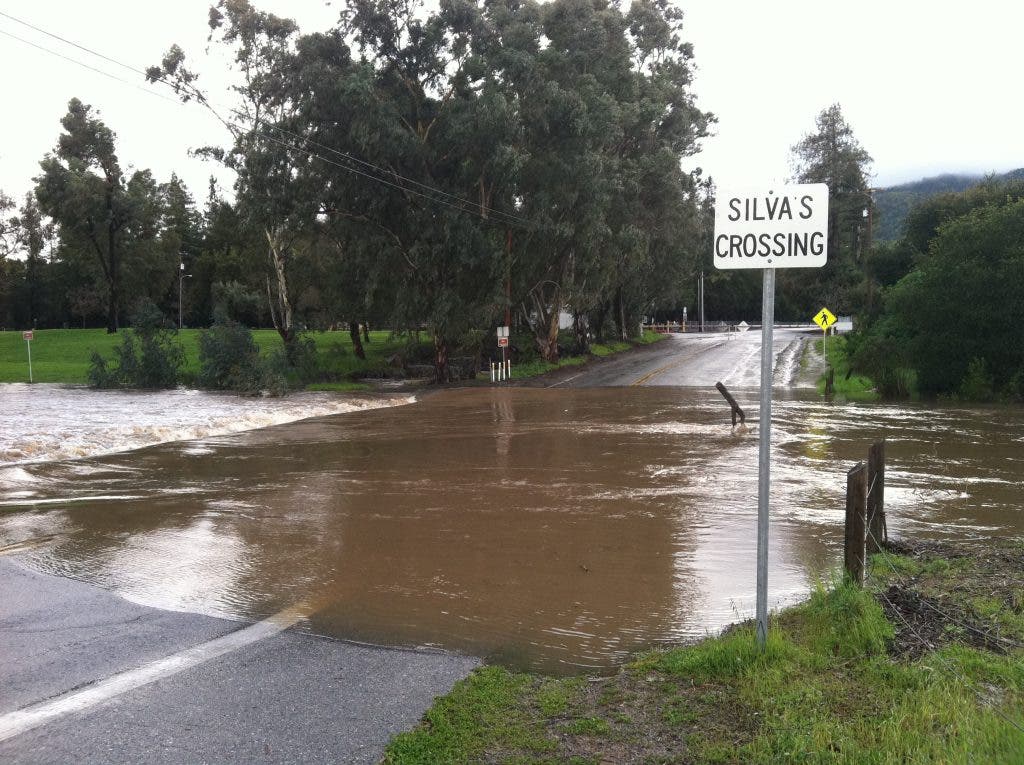


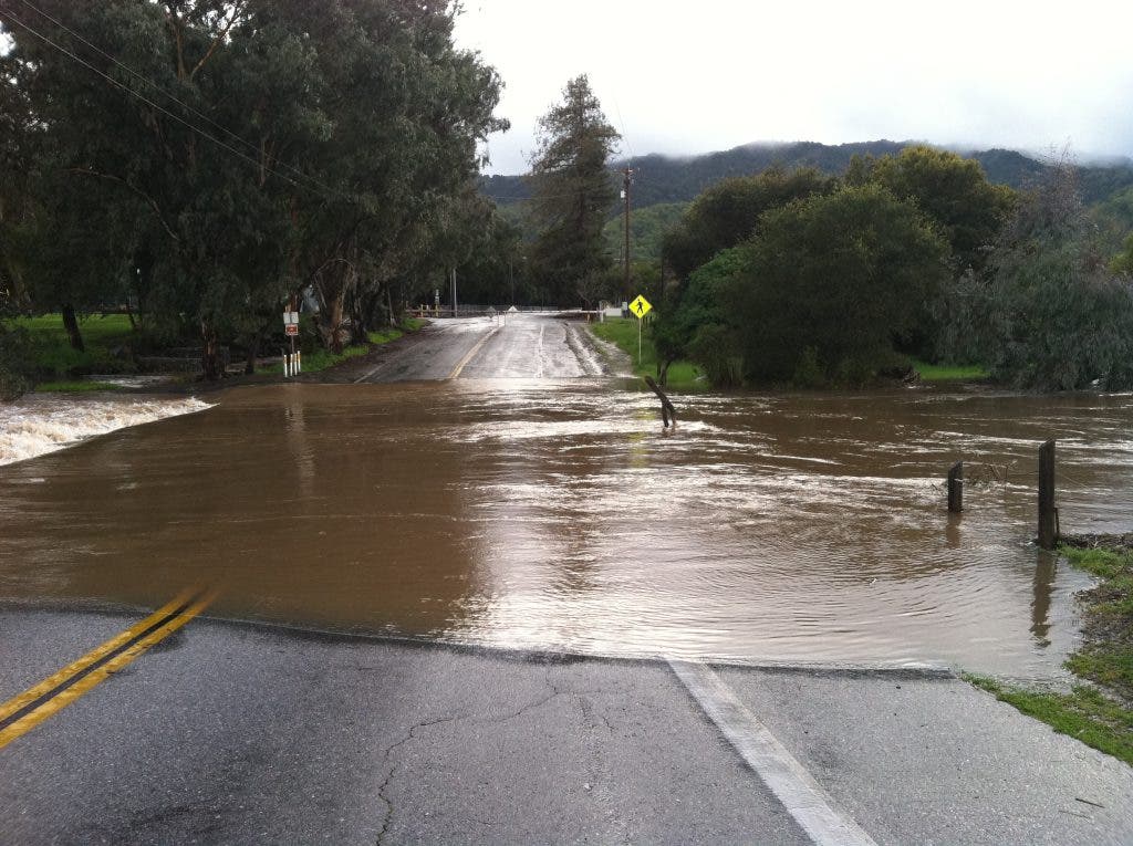

As rains continue to fall around the region, the city of Gilroy has closed Silva’s Crossing, a bridge on Miller Avenue that spans Uvas Creek near Christmas Hill Park.
Called a “summer crossing,” engineers designed the bridge to be “over-topped” by water when the creek water rises to a critical point, said Gilroy Operations Manager David Stubchaer
The crossing has been closed since 8 a.m. Monday, said Stubchaer.
Find out what's happening in Gilroywith free, real-time updates from Patch.
Uvas Reservoir, west of San Martin, holds 3.2 million gallons of water and feeds into Uvas Creek during “spillover” conditions, Stubchaer said. Those conditions could continue for the next three days, giving city staff reason to keep a close eye on the creek, according to the Santa Clara Valley Water District.
Determining when to close the summer crossing and the scaling of the city's flood response occurs in four phases, said Joe Kline, the city's public information officer.
Find out what's happening in Gilroywith free, real-time updates from Patch.
- Phase I: The Gilroy Police Department closes the crossing when water levels are anticipated to rise. At the moment that water over-tops the bridge, a marker further down the creek at Luchessa Avenue reads 189 feet above sea level. Staff monitors the level hourly.
- Phase II: When water reaches 196 feet at the West Luchessa Bridge, the Gilroy Fire Department begins monitoring the level every 15 minutes.
- Phase III: At 198 feet, the city will activate the Measurements are taken every 15 minutes, but more focus is given to weather and volume projections.
- Phase IV: “When the water level reaches 199.5 feet, the city will be in full emergency operation,” said Kline.
Gilroy experienced widespread flooding in 1986, Kline said, prompting the Army Corps of Engineers to construct a series of flood control channels throughout the city.
“These improvements have by no means eliminated the potential for flooding in Gilroy, but they have substantially reduced the potential for flooding in large areas of the city,” Kline said.
For those affected by the closure, alternate routes include Luchessa Avenue, Third and First streets.
A true bridge spanning Uvas Creek may one day extend from Tenth Street. The proposal is part of Gilroy’s long-term Traffic Circulation Master Plan.
Get more local news delivered straight to your inbox. Sign up for free Patch newsletters and alerts.

